Geography of the South Shetland Islands
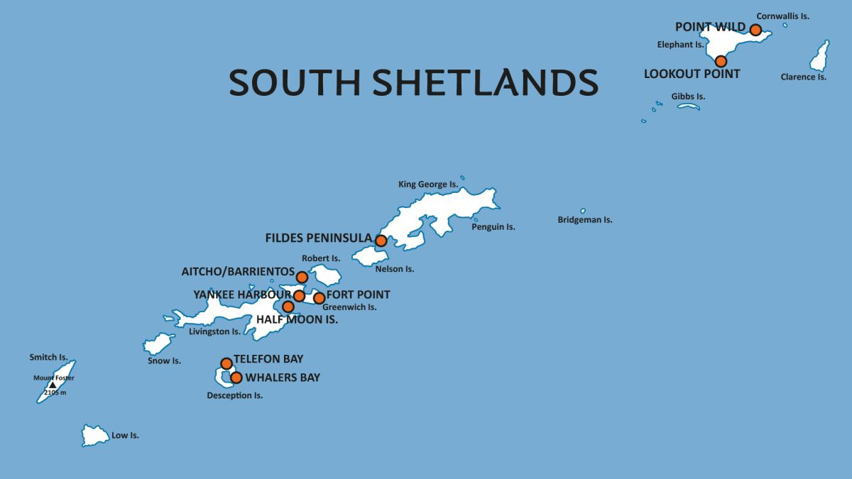
The South Shetland Islands are a remote archipelago located about 120 kilometers (75 miles) north of the Antarctic Peninsula.
These islands, although often overshadowed by their Antarctic neighbor, have a geography that is both rugged and diverse, shaped by glaciers, volcanic activity, and the harsh Southern Ocean.
Spread over roughly 3,687 square kilometers (1,423 square miles), the islands are home to a range of ecosystems, making them a fascinating part of the Antarctic region.
Each of the South Shetland Islands has its own unique geographic characteristics:
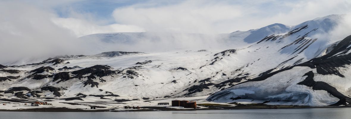
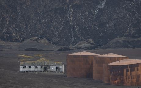
- Deception Island: Known for its active volcano and the flooded caldera, which forms Port Foster. The island’s volcanic landscape contrasts sharply with the surrounding icy waters.
- King George Island: The largest island in the archipelago, home to several research stations from countries around the world. It has expansive glaciers and a variety of coastal landscapes, from sheltered bays to steep cliffs.
- Elephant Island: Famous for its role in the survival story of Ernest Shackleton’s crew, Elephant Island is remote and rugged, with steep cliffs and ice-covered mountains.
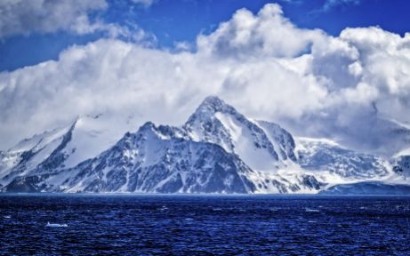
- Livingston Island: Known for its large ice caps and glaciers, this island has some of the most dramatic landscapes in the archipelago, including towering peaks and vast ice fields.
Facts about Geography of the South Shetland Islands
- Antarctica
- South Shetland Islands
Volcanic Landscape
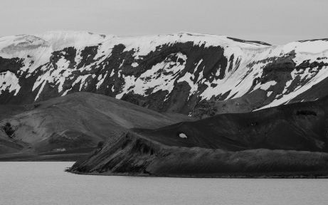
One of the defining features of the South Shetland Islands is their volcanic origins. The islands were formed by volcanic activity, and some of the islands are still active today. The most well-known is Deception Island, which has a large, flooded caldera that forms a natural harbor. This caldera, known as Port Foster, is a unique feature that allows ships to sail directly into the island’s volcanic crater. The island has experienced several eruptions, the most recent in 1970, leaving behind a landscape that is both desolate and captivating, with steaming beaches and barren volcanic rock.
Other islands, like Penguin Island, also show evidence of volcanic activity, with lava flows and volcanic cones that tell the story of the islands’ turbulent past. These volcanic formations give the islands a distinctive character, setting them apart from the surrounding Antarctic landscapes.
Glaciers and Ice Sheets
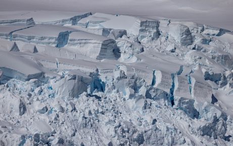
Glaciers play a significant role in shaping the South Shetland Islands’ geography. The islands are covered in glaciers and ice sheets, particularly on the larger islands like King George Island and Livingston Island. These glaciers slowly move toward the coast, where they break off into icebergs, contributing to the ever-changing landscape. King George Island, the largest in the group, is known for its sprawling glaciers, such as Collins Glacier and Greenwich Glacier, which dominate the interior.
The interplay between the glaciers and the volcanic activity on the islands creates a dynamic environment where ice and fire coexist. This constant movement of ice, coupled with the volcanic history, shapes the coastlines, carving out fjords and valleys.
Rugged Coastlines and Fjords
The coastlines of the South Shetland Islands are rugged and varied, ranging from steep cliffs to sheltered bays and deep fjords. Islands like Livingston and Elephant Island are known for their steep, ice-covered cliffs that plunge into the Southern Ocean. These cliffs provide critical habitats for seabirds and penguins, which nest on the rocky outcrops above the ocean. The islands are also dotted with fjords, narrow inlets of sea between cliffs, formed by the movement of glaciers.
The Bransfield Strait, which separates the South Shetland Islands from the Antarctic Peninsula, is another important geographic feature. This body of water, rich in marine life, plays a key role in the oceanic currents that affect the islands' weather and marine ecosystems.
Harbors and Inlets
The South Shetland Islands have several natural harbors and inlets that make them important for scientific research and exploration. The sheltered bays on King George Island and Deception Island are ideal for research stations, as they provide protection from the often harsh conditions of the Southern Ocean. Admiralty Bay on King George Island is a large, glacier-fed bay that has long been a hub for scientific activity, with multiple international research stations established along its shores.
Climate and Weather Patterns
Despite their proximity to the Antarctic, the South Shetland Islands have a relatively mild Antarctic climate due to their location just north of the Antarctic Peninsula. Summers can see temperatures hover around 1°C (34°F), while winters are much colder, often dipping below -10°C (14°F). The islands are frequently buffeted by strong winds and experience high levels of precipitation, mostly in the form of snow.
The proximity of the islands to the Southern Ocean and the Bransfield Strait means that the islands are heavily influenced by oceanic currents, which can bring sudden changes in weather. The waters surrounding the islands are rich in nutrients, supporting a diverse marine ecosystem, but they are also notoriously rough, with frequent storms and sea ice creating hazardous conditions for ships.